 Case studies
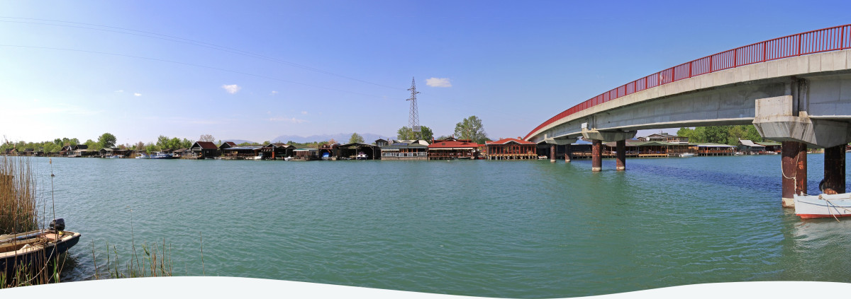
The transboundary Buna/Bojana Watershed is shared by Albania and Montenegro, facing multiple pressures, including unsustainable agricultural methods, active tourism, altered hydrological regimes from hydropower generation and flood control measures. Albania and Montenegro share some social and economic similarities but differ in legal and institutional frameworks. Thus, both countries recognized the need to strengthen their cross-border cooperation through the development of an integrated water resource plan for the watershed.
Background
The Buna/Bojana river is a short 44 km river with the third largest annual mean discharge in the region, after the Rhone and Po, reaching 20 km3/yr. The river begins at the southern outflow of the Shkoder/Skadar Lake and ends at the coastal zone of the Adriatic Sea, forming a delta of major ecological and touristic interest. Lake Shkoder/Skadar is the largest lake in southeastern Europe, situated close to the city of Shkodra, and receives water from the Great Drin River. The lake is protected under the RAMSAR Convention as it supports greater than 200 migratory bird species of international significance, as well as a highly diverse community of aquatic animals, plants, and fish. The respective regimes of Drin River and Lake Shkoder/Skadar directly influence the hydrological and ecological status, the aquatic quality, and the sediment regime of Buna/Bojana basin (European Commission, 2014). The river basin of Buna/Bojana is composed by limestone, sandstone, shales, and recent deposits whereas the marine zone is characterized by an extended continental shelf that reaches its maximum extension at about 60 - 80 cm from the coastline. At the outflow of Buna/Bojana river, the deltaic landscape and the Ada island, an island of important ecological interest, were formed under high flood events. The delta includes several lagoon complexes and freshwater lakes. The inland portion of the watershed includes agricultural land covering approximately 40% and several urban settlements on both sides of the river borders; on Montenegro's side the municipality of Ulcinj and on Albania' s side four communes from the county of Shkoder and several smaller parts of other communes. Most of the settlements share similar economic and social challenges as well as environmental risks. The complexity of the landscape components of the Buna/Bojana watershed, as well as its transboundary nature, make it an interesting case for study and analysis. Natural linkages between lakes and rivers, brackish waters and groundwater, inland and coastal zones in the area as well as the ongoing development of the socio-economic activities, and the lack of legal framework for sustainable management represent the main aspects of the watershed required to be analyzed and further addressed.
Actions taken
The Plan was completed with cooperation between the following partner organisations: the Regional Activity Centre for the Priority Actions Programme (PAP/RAC), Global Water Partnership Mediterranean (GWP-Med), UNESCO-International Hydrological Programme (UNESCO-IHP) and two teams of National (Albanian and Montenegrin) experts. A Steering Committee was established to operationalise the Plan's progress.
Two stakeholder workshops and several local community focus group discussions were held to support Plan development including setting a vision for the watershed and gathering data for the watershed analysis. The Plan was completed over a 5-year time frame in 2015, with cooperation between partner organizations (GWP-Med, PAP/RAC, UNESCO-IHP). During the development of the Plan, several meetings took place. A Steering Committee was organized to allocate the organizational structure, purpose, roles, and process of the operational scheme of the Plan. Two stakeholder workshops at the transboundary level were held: one at the beginning to discuss the vision of the area, as well as one at the end of the process to present the key findings of the watershed analysis. Several focus group discussions with local communities took place to contribute valuable stakeholder analysis of the Buna/Bojana watershed.
The Plan, developed with an integrated approach, recommended the following objectives:
- Enhance transboundary governance and cooperation for ecosystem conservation of the watershed and its respective services provided;
- Support policy reforms at the national and transboundary levels, especially regarding spatial planning;
- Compile all data into a knowledge system, enabling knowledge sharing capacities for the management of the transboundary system, as well as for improving monitoring systems;
- Improve the ecological and chemical status of water bodies and safeguard the availability of good water quality, while maintaining the hydrological conditions of the water bodies;
- Improve the quality of the landscape while protecting the biodiversity and natural values of the watershed;
- Support economic activities through the development of green jobs; and
- Promote the development of climate change adaptation infrastructure in the area to protect from natural disaster impacts.
Outcomes
The Integrated Water Resources Management Plan for Buna / Bojana area (“the Plan”) was developed as a pilot activity in the framework of the GEF UNEP/MAP Med Partnership Project demonstrating the implementation of the new Integrative Methodological Framework (IMF). The IMF supports and enables planners and interested parties to make efficient use of the limited resources in coastal zones.
The Plan reflects the priorities of the watershed and its inhabitants and implementation activities are designed to address local, national, and transboundary needs. These include a mix of infrastructure-based activities and soft tasks like pricing, trainings, awareness-raising campaigns, capacity building activities, spatial planning and land policy instruments, and improved monitoring systems. Creation of the Plan also stimulated the drafting of a Framework Agreement for the Sustainable Management of Skadar/Shkodra Lake Basin and Buna / Bojana area, as requested by the Montenegrin Minister of Sustainable Development and Tourism. Though the Agreement has yet to be signed, it is an initial step towards bilateral cooperation on the watershed between Albania and Montenegro.
Lessons Learned
Transboundary IWRM requires political stability and institutional will from all relevant players to be successful.
External actors can play an integral role in building momentum towards the development of an integrated water resource plan, especially in a transboundary context.
The IMF, developed specifically for integrated management of Mediterranean ecosystems, was piloted for this watershed. It proved to be a useful and thorough framework, recommended to be utilized in other transboundary and coastal watersheds to support RBMP development.
Multi-stakeholder partnerships formed during the development of the Plan are key in strengthening local ownership, building trust, and promoting visibility of the partners in the area. These should be supported and continued during Plan implementation stages.


